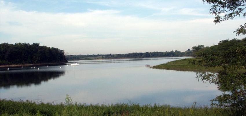
Half Moon Bay has plenty of outdoor activities all year, thanks to relatively consistent weather! It is only a 30-minute drive from San Francisco, making it an ideal day trip for exploring Northern California’s coast.
Aside from surfing, hiking on one of the many Half Moon Bay hiking trails is a popular activity. The best thing about Half Moon Bay hiking is seeing the area’s diverse landscape, including panoramic coastal views, Redwood and Cypress tree forests, and more.
There is also a Half Moon Bay hiking trail for every activity level. Half Moon Bay has a hiking trail for you whether you want a brisk morning or sunset hike or a full-day adventure. The following are the top Half Moon Bay hiking trails, California.
This guide overviews many of Half Moon Bay’s most popular hiking trails. They range from short, flat, easy hikes to more strenuous hilly hikes.
While most of these hikes will provide you with coastal views, some will take you further inland, allowing you to experience foggy forested areas.
How Is The Weather In Half Moon Bay?
Half Moon Bay hiking is a wonderful experience. It is difficult to escape the fog in Half Moon Bay. Half Moon Bay, like San Francisco, has its own microclimates, which can be shrouded in moisture in the mornings (and sometimes for much of the day).
However, the days are usually warm once the sun breaks through the fog, even in the winter. So our best advice is to dress in layers that you can easily remove and tie around your waist or carry in a backpack.
Winters can be wet, and living near the ocean means the coastal breeze will strengthen during the colder months. Throughout the year, temperatures typically range from 45°F to 67°F.
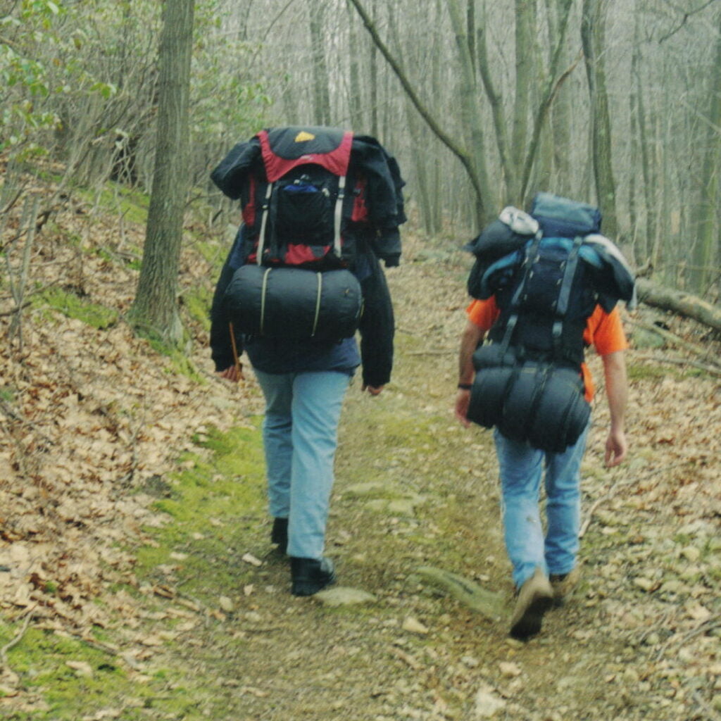
What Should You Wear While Hiking in Half Moon Bay?
As previously stated, dress in layers you can remove as the day warms up or warm up on a hike. The day may begin cloudily, but by the end of your walk, the sun may be shining!
Hiking pants with zippers: Yoga pants aren’t appropriate for hiking. The pockets of most yoga are too small to hold a phone and aren’t zippered. Invest in some zippered hiking pants instead of losing out on essential things such as your phone or keys.
Bring the following footwear: Tennis shoes or sports sandals are appropriate for some more accessible Half Moon Bay walking trails.
However, some of the Half Moon Bay hiking trails with elevation require more grip, so I recommend trail runners or hiking boots. We’ve noted the height below so you can figure out what to wear before you go.
Other things to keep in mind are:
- Even when it’s cloudy, wear sunscreen.
- Hat – because there aren’t many trees on coastal walks, shade is limited.
- Reusable water bottle – even if some of the hikes are short, you will become thirsty.
- A picnic or a snack – make a day of it by bringing a picnic lunch or a snack to keep you going.
- Download your maps – phone reception isn’t always reliable, so be prepared.
- Sneakers: If you have hiking shoes, wear them, but sneakers are acceptable for most of these trails.
- Backpack: Choose a comfortable gear that will not dig into your shoulders.
The Half Moon Bay Hiking Trails
Now that we’ve gotten all of the “administrative” stuff, we can focus on the fantastic Half Moon Bay hiking trails.
Gray Whale Cove Trail
Gray Whale Cove Trail is the most accessible Half Moon Bay hiking trail on Montara Mountain. It’s a two-mile out-and-back trail with spectacular ocean views the entire way. The hike begins with a slight incline, but it quickly levels out and is mostly flat for the rest of the way as you weave along the mountainside.
Because of the narrow dirt path, you’ll need to move away to pass people. For these encounters, make sure you have your mask or buff ready. Also, keep an eye out for mountain bikers, as there are many bike trails on this mountain, but they are very good at making themselves known.
One section of the trail leads to an overlook with two benches, where we recommend stopping for a few moments to take in the Half Moon Bay views and watch the surfers below. This would be an excellent location to enjoy the setting sun.
Gray Whale Cove Trail is an excellent place to stretch your legs while on Highway 1. It is neither too strenuous nor tiring! It will take just half an hour to return – depending on how many photo opportunities you take.
- Out and back distance: 2 miles
- Time required: 30-45 minutes
- Pathway: Narrow dirt path
- Difficulty: Simple
- Shoes: Good-tread sneakers or hiking boots
Cowell-Purisima Trail
This hike can be started from one of two trailheads off Highway 1.
This Half Moon hiking trail is named after the two farms that line the coast here, Cowell Ranch and Purisima Farms. The trail runs between farmland and the beach, providing stunning views of the ocean in one direction and beautiful pastoral views in the other.
The trails are mainly gravel and wide, with a few sturdy bridges over marshlands and Purisima Creek. Remember that this is a popular cycling route, so keep your ears peeled and stay to one side of the trail, especially around blind corners.
- Out-and-back distance: 7 miles
- The trail is easy and flat.
- Trailhead: Cowell Ranch Beach or further south across from Bob’s Vegetable Stand.
Please remember that this trail is only open on weekends and holidays from 8 a.m. to sunset.
Aside from the cliffs and sandy beaches below, look for rocky outcrops where seals will be basking in the sun, particularly at Seal Rock.
The Devil’s Slide Trail
This paved trail was the primary route from San Francisco and Pacifica to the Coastside. As the name implies, the area was plagued by numerous landslides.
This is an excellent Half Moon Bay hiking trail for kids, strollers, and dogs. It’s worthwhile because the ocean views are spectacular, especially from the south parking lot. Because the Devil’s Slide is on a headland rather than in a bay, you may even see migratory whales.
- The distance is 3.1 miles.
- 436 feet in elevation
- Parking is available at both the north and south ends of the trail.
- Yes, it is dog-friendly.
The McNee Ranch Trail/Montara Mountain Loop
Montara State Beach Park includes the McNee Ranch property. This Half Moon hiking trail is unique because you can climb high and get wide-angle coastline views with a little more effort. The trail surface is dirt, and most of it runs through open scrub, but there is one section that has dense trees.
The north side section of the trail is very steep; we found it easier to approach it counter-clockwise rather than risk sliding down it. However, if you walk clockwise, you will see more. In either case, proper footwear and hiking poles are required.
The trail routes in this area are extensive, and you can quickly go beyond the 3.3-mile Montara Mountain Loop. Both options are the 4.8 miles (1,200-foot) or the 5.8-mile (1,800-foot) Alta Vista Montara Mountain Loop.
- 3.3-mile distance
- 734 feet in elevation
- There is a parking lot at the trailhead, but there is more parking at Montara Beach or Gray Whale Cove.
- Yes, it is dog-friendly.
Fitzgerald Marine Reserve
This fantastic Half Moon Bay hiking trail includes tidepools, Cypress Tree tunnel, cliff views, and possibly a seal!
It’s in Half Moon Bay’s Moss Beach neighborhood, near the Moss Beach Distillery – a great place to eat in Half Moon Bay.
Walk towards the neighborhood from the parking lot, and you’ll come across a tiny bridge to your right with a signpost. Follow the signs for Cypress Road after crossing this bridge. You’ll come across a stunning Cypress Tree Tunnel that begs to be photographed. Keep hiking along this path towards Seal Cove Beach Staircase once you’re satisfied with your Instagram-worthy shot.
Along the way, there are benches. You can sit and relax here for a few minutes. Quite a few people have witnessed Seals on the beaches below, so keep your distance.
- 1 mile in length
- Time required: 15-30 minutes
- Difficulty: Simple
- The terrain is a flat forest floor.
- Sneakers are perfectly acceptable.
Miramontes Point Loop

This excellent paved, short loop Half Moon Bay hiking trail at Miramontes Point is complete with all of the Ritz Carlton Hotel’s amenities. This is the hike for you if you want a short walk with the promise of coffee at the end.
You’ll circle the building to Miramontes Point from the Ritz Carlton parking lot. Climb the wooden fence to view the ocean, lush coastal vegetation, and flowers. Return to the parking lot by following the trail to the Coastal Trail.
- Loop distance: 0.9 mile
- Trail difficulty: Easy, paved
- The Ritz Carlton Hotel serves as the trailhead (25 public parking available at the hotel)
- On this day, dogs must be kept on a leash.
Pillar Point & Mavericks Trails
Mavericks is probably best known for its massive winter waves and the long-running big wave competition. However, it is also a popular dog-friendly and family-friendly beach.
The Pillar Point trail is a pleasant, easy hike with good mid-distance and spectacular ocean views amongst all other Half Moon Bay trails. The trek provides beautiful views of Ross Cove beach and Pillar Point harbor.
- 3.7-mile distance
- 259 feet in elevation
- Parking: There is a lot at Mavericks Beach (which fills up quickly) and another on the airport’s west side.
- Yes, it is dog-friendly.
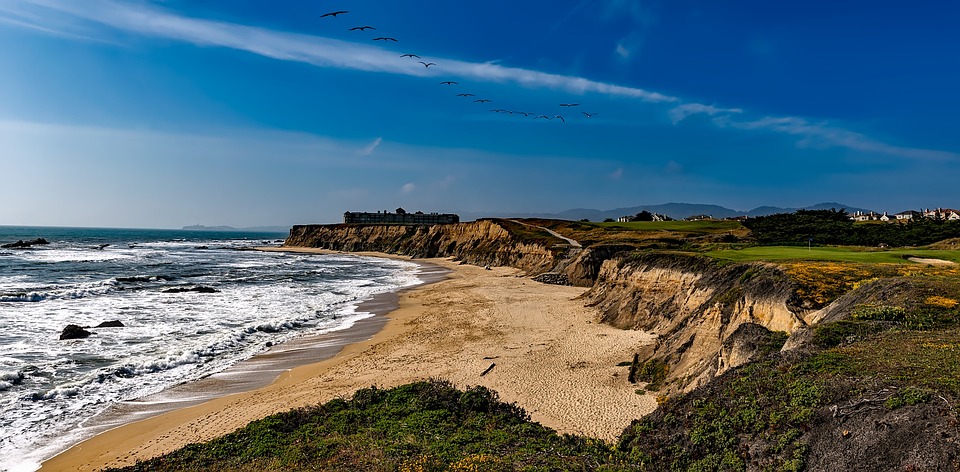
The California Coastal Trail – From Surfer’s Beach to Francis Beach
It is part of a grand plan to make California’s entire coastline walkable. About half of the trail is finished, with sections in the Bay Area, including the Golden Gate Bridge, the Lands End hike, and a descent through Ocean Beach. There are snippets of it throughout Pacifica before the trail resurfaces firmly at the Devil’s Slide.
However, the section of the Coastal Trail south of Pillar Point Harbor and Surfer’s Beach is one of the most beautiful. This paved pedway is suitable for dogs, children, bicycles, and strollers. You travel through cypress trees along a bluff with stunning beach views.
Your starting and ending points are flexible, but the entire loop is 6.2 miles.
- Round trip distance: 6.2 miles
- Elevation: insignificant
- Parking is available on the street at Surfer’s Beach and in-state beach parking at Dunes, Venice, and Francis beaches.
- Dog-Friendly?: The pedway along the bluff is dog-friendly, but they are not permitted on the beach.
Purisma Creek Redwoods Open Preserve
The Purisma Creek Redwoods Open Preserve is home to the famous coastal Redwoods of California! Hikes here combine all of California’s natural splendor, including views of the Pacific Ocean, Redwood forests, and babbling creek.
Purisma Creek can be reached via Highway 35, Higgins Canyon Road, or Purisma Creek Road. Parking is limited, so if you plan to visit on the weekend, you need to reach early, as this is a popular Half Moon bay hiking trail.
Purisma Creek Redwoods Preserve has several hiking trails suitable for all skill levels, including North Ridge Trail – Whittemore Gulch – Harkins Ridge – North Ridge Trail.
- Time: 3-4 hours
- Length: 8 miles
- Narrow dirt paths are the terrain.
- Difficulty: Difficult
- Shoes: Hiking boots or shoes
The one more trail is the Purisma Creek Trail, the Craig Britton Trail, and the Harkins Ridge Trail.
Poplar Beach Trail
It’s a fantastic Half Moon Bay hiking trail. This flat walk will take you along the coastal cliff sides, providing stunning views of Poplar Beach and the Pacific Ocean.
Because this is such a short and easy trail, it is trendy, so expect to see a lot of hikers and bike riders. You won’t find much shelter from the elements on this trail, so be prepared for the coastal breeze to whip you around.
- Out-and-back distance of 1.5 miles
- The trail is easy and flat.
- Poplar State Beach is the trailhead at the end of Poplar Street.
- This trail requires dogs to be kept on a leash.
San Gregorio State Beach
This is the Half Moon Bay hiking trail for you if you want to go exploring among the driftwood and cross some water.
During the winter, a creek frequently cuts through the sandy beach. People get creative by building small bridges out of driftwood, usually strewn across the beach. You can also be brave and remove your shoes and socks to go for a swim in the water.
Walk down to the beach from the southwest corner of the parking lot, near the picnic benches. After crossing the creek, walk along the coast. During migration season, keep an eye out for breaching whales. You’ll come across a small cave in the sandstone cliff, and if it’s been a rough week, you might get lucky and see a waterfall.
- Out-and-back distance: 2.9 miles
- Difficulty: Simple
- San Gregorio State Beach Parking Lot is the trailhead.
- Dogs are permitted.
- Map of the trail
Whittemore Gulch And Harkins Ridge Loop Trail
This trail within Purisima Creek Redwoods Preserve will give you a forest feel. Still, it is also a very strenuous hike. If you have knee problems, you should probably skip this hike.
The first half is a switchback descent that can become muddy after rain, so bring a change of shoes to avoid muddying up your car on the way back. Please don’t rush through this hike section; it’s where you’ll see the redwoods and has an excellent shady area.
When you get down to Whittemore Gulch, you’ll hear the creek bubbling away if there’s been some rain or if it’s winter. While hiking the gulch area, keep an eye out for wildflowers.
It’s time to begin the climb once you reach Harkins Ridge Trail. What goes down must come up in this case. So you’ll have to pay for all of that lovely downhill hiking. The steep incline will be felt, and you will likely have to stop a few times to catch your breath.
You’ll have plenty of opportunities to enjoy the views of Half Moon Bay from Harkins Ridge Trail, hence even though little difficult this is one of the worth experiencing Half Moon Bay hiking trail.
- Loop distance: 7.6 miles
- Difficulty: Difficult, 1,853 feet descending and climbing
- Trailhead: From the Skyline Boulevard entrance parking lot.
- Purisima Creek Redwoods Preserve is currently closed due to wildfires in 2020.
- Map of the trail
Burleigh Murray State Park Trail
This small state park is a former ranch property located in a quiet valley south of HMB that includes an old historic barn and outbuildings. The Burleigh Murray State Park Trail is a simple, wide path with a mix of open space and trees. For the entire duration of this Half Moon hiking trail, you walk alongside a small river.
If you want some alone time, this is an excellent hike.
- Out and back distance: 3.9 miles
- 301 feet in elevation
- Parking is available at the trailhead.
- Is it dog-friendly? No
Conclusion
These Half Moon Bay hiking trails are a great place to start exploring the beautiful Northern California coast. It’s incredible how we can hike from towering Redwood forests to sweeping coastal views on the same day! Check out our blog for great information on the best camping and RV parking spots in the Bay Area.